
Planning a Meshtastic or any other wireless network, optimizing antenna placement, or simply curious about what you can see from a specific location? Do you need to know the visibility between two points? Google Earth Pro offers powerful tools for line of sight analysis. This guide shows you how to check line of sight in Google Earth Pro, empowering you to make informed decisions based on visual data. We’ll cover everything from using the Google Earth Pro Viewshed Tool to manual measurement techniques, ensuring you have a comprehensive understanding of how to leverage Google Earth Pro for your needs.
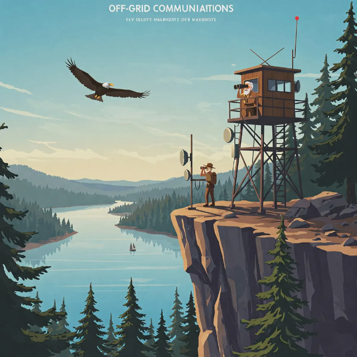
Optimizing Meshtastic Node Placement with Google Earth Pro #
Effective Meshtastic network deployment depends on establishing reliable communication links between nodes. A critical factor in achieving this is ensuring a clear line of sight between these nodes. Obstructions like buildings, trees, and terrain can significantly impede signal propagation, reducing range and reliability. Google Earth Pro provides several tools that can assist in line of sight analysis for optimal Meshtastic placement.
Step-by-Step Guide: How to Check Line of Sight in Google Earth Pro #
Here’s how to do a line of sight analysis with Google Earth Pro:
-
Establish Placemarks: Begin by placing placemarks at the locations where you intend to deploy your Meshtastic nodes. These placemarks will serve as reference points for your analysis.
-
Measure Distance and Azimuth: Utilize the ruler tool to measure the distance between potential node locations. This tool also provides the azimuth, which is the compass bearing between the two points. Knowing the distance is crucial for understanding potential signal loss, while the azimuth helps in aiming antennas. Save the path that you create. Then, in the altitude tab, change ‘clamped to ground’ to ‘relative to ground’.
-
Elevation Profiles: Google Earth Pro can create elevation profiles along a path you define. Right-click on a line you’ve created between two points and select “Show Elevation Profile”. This visual representation of the terrain between two points is invaluable in identifying potential obstructions.
-
The Viewshed Tool: The Viewshed tool is a Google Earth Pro exclusive feature that highlights areas visible from a specific point. To use it, right-click on a placemark and select “Show Viewshed”. Google Earth Pro will then calculate and display the areas with a direct line of sight to that placemark in green, while obstructed areas are shown in gray. It is important to adjust the altitude of the placemark so that it is at least two meters above the surface.
Accuracy Considerations for Google Earth Pro Line of Sight Analysis #
While Google Earth Pro is a valuable tool for line of sight analysis, it’s important to understand its limitations:
- Data Resolution: The accuracy of Google Earth Pro’s terrain data varies depending on the location. In some areas, the resolution may be sufficient for identifying major obstructions, but it may not capture smaller details like individual trees.
- Building Data: While Google Earth Pro includes 3D models of buildings in many urban areas, this data may not be complete or up-to-date. New construction or changes to existing buildings can affect line of sight.
- Vegetation: Google Earth Pro’s representation of vegetation can also be limited. Tree canopies can change significantly over time, and the software may not accurately reflect the current state of vegetation.
Beyond Google Earth Pro: Advanced Meshtastic Planning #
While Google Earth Pro offers valuable tools for line of sight analysis, dedicated tools like the Meshtastic Site Planner are specifically designed for optimizing Meshtastic network coverage. These tools often incorporate more detailed terrain data, propagation models, and other features tailored to Meshtastic networks.
By combining the visual analysis capabilities of Google Earth Pro with specialized planning tools, you can make well-informed decisions about Meshtastic node placement, maximizing network range and reliability. Consider this approach for more complex deployments.
Understanding Line of Sight and Its Diverse Applications #
Line of sight refers to the unobstructed visual path between two points. In various fields, determining line of sight is crucial for:
Wireless Communication: Ensuring Reliable Signal Transmission #
In wireless communication, establishing a clear line of sight is paramount for efficient signal transmission. Planning the placement of antennas and relay stations hinges on identifying areas where a direct, unobstructed path exists between transmitter and receiver. Obstacles like buildings, trees, and terrain can impede the signal, leading to reduced performance or complete signal loss. Tools like Google Earth Pro offer features to analyze the line of sight, taking into account terrain and even 3D models of buildings. This allows for informed decisions on antenna placement, height adjustments, and the strategic use of relay stations to overcome obstructions and ensure reliable wireless communication.
Real Estate: Maximizing Property Value Through Viewshed Analysis #
Assessing the views from a property is a key aspect of real estate valuation. A property with expansive, unobstructed views typically commands a higher price. Determining the line of sight helps prospective buyers understand the quality and extent of the views they can expect. Real estate agents can use tools like the Viewshed tool in Google Earth Pro to remotely evaluate views and factor them into property pricing. This tool highlights areas visible from a specific point, providing a visual representation of the property’s viewshed.
Construction: Minimizing View Obstruction During Development #
In construction planning, evaluating the impact of new buildings on existing views is essential. New developments can potentially block or diminish the views from neighboring properties, leading to disputes and decreased property values. By analyzing the line of sight before construction begins, developers can assess the potential impact and make design modifications to minimize view obstruction. This proactive approach can help mitigate conflicts and ensure that new construction integrates harmoniously with the surrounding environment.
Urban Planning: Shaping Cityscapes with Visual Impact Assessments #
Urban planning involves analyzing the visual impact of proposed developments on the cityscape. New buildings, infrastructure projects, and other developments can alter the visual character of an area, affecting its aesthetic appeal and the overall quality of life for residents. Understanding the line of sight allows urban planners to assess how these developments will be perceived from different vantage points and to make informed decisions about building height, placement, and design to minimize negative visual impacts.
Military and Surveillance: Optimizing Observation Post Placement #
Determining visibility from observation posts is critical in military and surveillance operations. The effectiveness of an observation post depends on its ability to provide a clear line of sight to the surrounding area. Factors such as terrain, vegetation, and buildings can obstruct the view, limiting the observer’s ability to detect and monitor activity. Analyzing the line of sight helps military planners and surveillance personnel select optimal locations for observation posts and to develop strategies for overcoming any visual obstructions.
Getting Started with Google Earth Pro for Wireless Network Planning #
Before we delve into the specifics of checking line of sight, ensure you have Google Earth Pro installed on your computer. It’s a free desktop application with advanced features compared to the web version, making it a valuable tool for planning wireless networks. The google earth pro download is readily available.
Downloading and Installing Google Earth Pro #
To begin your wireless planning journey, you’ll need to get Google Earth Pro set up. Here’s a simple guide:
- Navigate to the Google Earth Pro download page. You can find it by searching “google earth pro download” or visiting the official Google Earth website.
- Download the appropriate version for your operating system (Windows, macOS, or Linux).
- Follow the installation instructions provided.
With Google Earth Pro successfully installed, you’re now ready to start leveraging its powerful features for wireless network planning. Remember to save your work often as you are working on your planning. The program is a little unstable and crashes a lot.
Methods for Checking Line of Sight in Google Earth Pro: Viewshed vs. Manual #
Google Earth Pro offers several methods for checking line of sight, each with its strengths and weaknesses. We’ll explore the two primary methods: the Viewshed tool and manual measurement techniques.
Viewshed Tool: Visualizing Visible Areas #
The Viewshed tool in Google Earth Pro is a powerful feature designed to visualize areas visible from a specific point. This is particularly useful for tasks such as evaluating potential building sites, assessing cell tower coverage, or planning advertising placements. To use the Viewshed tool, you first need to place a placemark at the location from which you want to analyze the visibility. Right-clicking on the placemark and selecting “Show Viewshed” initiates the calculation. Google Earth Pro then highlights the areas with a direct line of sight in green and areas obstructed from view in gray. It’s important to note that the accuracy of the Viewshed tool depends on the terrain data and the presence of 3D models, including buildings and trees, in Google Earth. The tool considers these elements when determining visibility. You may need to adjust the altitude of the placemark for a more realistic assessment, especially if you are simulating the view from a certain height. The Viewshed tool offers a quick and intuitive way to get a general understanding of visibility from a given location, making it a valuable asset in planning and analysis.
Manual Measurement Techniques: Precision and Control #
Manual measurement techniques in Google Earth Pro primarily involve using the ruler tool to draw lines and analyze elevation profiles. This method provides a more hands-on approach to assessing line of sight. To begin, you can use the ruler tool to measure the distance and azimuth between two points. After saving this measurement, you can adjust the line’s properties, such as changing the “Clamped to Ground” setting to “Relative to Ground” and specifying an altitude to represent the height of structures. By checking the “Extend path to ground” option, Google Earth Pro draws a line that visually indicates whether the path intersects with terrain or other objects, thus revealing potential obstructions. Additionally, the elevation profile feature allows you to examine the elevation changes along a path. Right-clicking on a line and selecting “Show Elevation Profile” displays a graph of the ground’s elevation beneath the line, which is extremely useful for determining line of sight, especially over uneven terrain. While manual measurement techniques may require more effort and careful consideration than the Viewshed tool, they offer greater control and precision, especially when accounting for specific heights and obstructions. These techniques are particularly useful when you need to analyze line of sight between points at different elevations or when you want to consider the impact of specific structures on visibility.
Mastering the Viewshed Tool for Accurate Line of Sight Analysis #
The Google Earth Pro Viewshed tool is a powerful feature used for viewshed analysis. It provides a visual representation of areas visible from a specific point. This tool considers terrain and 3D models, including buildings and trees, to calculate visibility, offering a comprehensive line of sight analysis.
Step-by-Step: Using the Viewshed Tool #
- Locate the point from which you want to analyze line of sight.
- Click the ‘Add Placemark’ button (pushpin icon) on the toolbar.
- Position the placemark at the desired location and give it a descriptive name.
- Right-click on the placemark you created.
- Select ‘Show Viewshed’ from the context menu.
- Google Earth Pro will calculate the visible areas, highlighting them in green. Areas without line of sight will be shaded in gray.
- The Viewshed tool may prompt you to adjust the placemark’s altitude. This is crucial for accurate results, especially when simulating the height of an antenna or a person’s eye level. You can manually set the altitude by right-clicking the placemark, selecting ‘Properties,’ and adjusting the ‘Altitude’ tab.
Manual Measurement Techniques for Precise Line of Sight Assessment #
While the Viewshed tool provides a broad overview, manual line of sight measurement techniques offer more granular control and allow you to assess line of sight between specific points. These methods, primarily using the Google Earth Pro ruler tool, provide a practical approach to understanding potential obstructions. Use these techniques to improve line of sight analysis and viewshed best practices.
Using the Ruler Tool to Measure Distance and Azimuth #
The first step in manual line of sight measurement is to determine the distance and direction between two points of interest. The Google Earth Pro ruler tool is ideal for this purpose.
- Click the ‘Ruler’ button on the toolbar.
- Select the ‘Line’ tab.
- Click on the starting point and then the ending point of your desired path.
- The Ruler window will display the distance and azimuth (direction) between the two points. This value is crucial for further analysis.
Creating a Path and Adjusting Altitude #
After establishing the basic line, you’ll need to create a path to represent the line of sight and adjust its altitude to reflect real-world conditions.
- After measuring the line, save it as a ‘Path.’
- Right-click the path and select ‘Properties.’
- In the ‘Altitude’ tab, change ‘Clamped to Ground’ to ‘Relative to Ground.’
- Set the altitude to the height of the objects at each end of the line (e.g., building height, antenna height).
- Enable ‘Extend Path to Ground’ to visualize the line’s trajectory. Setting the correct altitude is vital for accurate manual line of sight measurement.
Analyzing the Elevation Profile #
The final, and perhaps most important, step is elevation profile analysis. This allows you to identify any terrain obstructions that might block the line of sight.
- Right-click on the path and select ‘Show Elevation Profile.’
- An elevation profile will appear at the bottom of the screen, showing the terrain along the path.
- Examine the profile to identify any obstructions that might block the line of sight. If the line you created goes through the terrain, there is no line of sight. This visual representation offers a clear understanding of the line of sight.
Answering Your Questions (People Also Ask): Google Earth Pro FAQ #
Let’s address some common line of sight questions related to Google Earth Pro. Here’s a Google Earth Pro FAQ, covering topics from Meshtastic link planning to property lines and coordinate finding.
Is there a Meshtastic link planner integrated with Google Earth Pro? #
While not directly integrated into Google Earth Pro, you can use Google Earth Pro to plan Meshtastic links. Export coordinates of potential nodes and use a separate Meshtastic link planner tool, or manually assess line of sight using the methods described above to determine suitable locations. Consider using Meshtastic Site Planner for detailed analysis.
How can I see property lines on Google Earth? #
Yes, but not directly. Google Earth Pro does not inherently display property lines. You can import property lines as KML/KMZ files, often obtained from local government GIS databases, professional surveys, or third-party services. Search online for resources such as ‘Show Property Lines on Google Earth: A How-To Guide’.
How do I measure line of sight on Google Earth Pro? #
This entire guide explains how to measure line of sight on Google Earth Pro using the Viewshed tool and manual measurement techniques. Refer to the sections above for detailed instructions, including using the ruler tool, elevation profiles, and the Viewshed feature. These tools help answer line of sight questions and determine optimal placement for various applications.
How do I find the exact coordinates in Google Earth Pro? #
- As you move your mouse over the map, coordinates are displayed in the lower-right corner of the Google Earth Pro window.
- You can change the coordinate format (Decimal Degrees, Degrees Minutes Seconds, etc.) in ‘Tools’ -> ‘Options’ -> ‘3D View’ (Windows/Linux) or ‘Google Earth’ -> ‘Preferences’ -> ‘3D View’ (Mac).
Can Google Earth Pro be used for viewshed analysis? #
Yes, Google Earth Pro is well-suited for viewshed analysis. It provides a visual representation of areas visible from a specific point, considering terrain and 3D models. This makes it useful for various applications, such as real estate, urban planning, and wireless communication.
How accurate is the elevation data in Google Earth Pro? #
The accuracy of elevation data in Google Earth Pro can vary depending on the location. In some areas, the resolution may be sufficient for identifying major obstructions, but it may not capture smaller details. Always verify your findings with real-world observations.
What are some limitations of using Google Earth Pro for line of sight analysis? #
Some limitations include varying data resolution, incomplete or outdated building data, and limited representation of vegetation. It’s important to be aware of these limitations and supplement your analysis with real-world observations when possible.
Can I use Google Earth Pro to determine the best location for a cell tower? #
Yes, Google Earth Pro can be a valuable tool for determining the best location for a cell tower. You can use the Viewshed tool to assess potential coverage areas and identify any obstructions that might interfere with the signal.
How can I account for trees and vegetation when analyzing line of sight in Google Earth Pro? #
While Google Earth Pro does not perfectly represent vegetation, you can estimate tree heights and adjust your altitude accordingly. Consider the density and height of vegetation in your area of interest.
What is the difference between the Viewshed tool and manual measurement techniques in Google Earth Pro? #
The Viewshed tool provides a broad overview of visible areas, while manual measurement techniques offer more granular control and allow you to assess line of sight between specific points. Both methods have their strengths and weaknesses, depending on your specific needs.
Tips and Tricks for Accurate Line of Sight Analysis #
Here are some additional tips to enhance the accuracy of your line of sight analysis in Google Earth Pro:
Use High-Resolution Imagery for Detailed Terrain Representation #
Ensure you are using the highest available resolution imagery for your area of interest. This improves the accuracy of terrain and object representation. Keep in mind that image quality and resolution can vary significantly depending on your location on Earth. Higher resolution imagery allows for a more detailed and accurate representation of the terrain, buildings, and vegetation, which are all crucial factors in determining line of sight. To improve line of sight analysis, viewshed best practices suggest using high-resolution imagery to accurately represent the terrain and any obstructions.
Consider 3D Models for Realistic Urban Assessments #
Enable the ‘3D Buildings’ layer to incorporate buildings and other structures into your analysis. This is especially important in urban areas. The Viewshed tool in Google Earth Pro takes into account not only the terrain but also any 3D models in the scene. In urban environments, buildings can significantly obstruct the line of sight, and including these 3D models provides a more realistic assessment. However, be aware that the accuracy of building heights can vary, so always verify the information where possible.
Account for Vegetation: Estimating Tree Heights in Rural Areas #
While Google Earth Pro does not perfectly represent vegetation, be mindful of tree cover, especially in rural areas. Estimate tree heights and adjust your altitude accordingly. Vegetation, particularly dense tree cover, can significantly impact line of sight. While Google Earth’s representation of trees might not be perfectly accurate, accounting for their presence and estimating their height is crucial for a more realistic analysis. You can use the ruler tool to measure the height of nearby buildings and use that as a reference for estimating tree heights. This is especially important when using the Viewshed tool for wireless network planning or determining potential obstruction for radio signals.
Verify with Real-World Observations: Ground Truthing Your Analysis #
Whenever possible, supplement your Google Earth Pro analysis with real-world observations and site surveys to confirm your findings. Despite the advancements in satellite imagery and 3D modeling, Google Earth Pro has limitations in accuracy, especially in complex terrain or areas with rapidly changing landscapes. Factors such as seasonal changes in vegetation, new construction, or modifications to the terrain can affect the actual line of sight. Therefore, ground truthing your analysis with on-site observations or surveys is essential to ensure the reliability of your results. This is a critical step to improve line of sight analysis and viewshed best practices. You can use the measure distance tool and the line draw tool to check line of sight between two points on Google Earth Pro.
Conclusion: Mastering Line of Sight Analysis with Google Earth Pro #
By mastering the Viewshed tool and manual measurement techniques in Google Earth Pro, you can effectively analyze line of sight for various applications. Whether you’re planning a wireless network, evaluating real estate, or exploring geographical visibility, Google Earth Pro provides a powerful and accessible platform for informed decision-making. By following viewshed best practices, you can be sure you are getting the most out of the tool.
Google Earth Pro Summary: A Versatile Tool for Visualizing Geospatial Data #
Google Earth Pro is a valuable desktop tool for visualizing geographical data and performing various analyses. Its strength lies in its ability to provide a realistic 3D view of the Earth, incorporating satellite imagery, terrain data, and even 3D models of buildings. This makes it particularly useful for line of sight analysis, where understanding the terrain and potential obstructions is critical.
Line of Sight Analysis Conclusion: Ensuring Clear Communication Paths #
The Viewshed tool is a key feature for line of sight analysis. By placing a placemark at a specific location and activating the Viewshed, the software highlights areas visible from that point in green, while areas obscured by terrain or objects are shown in gray. This allows users to quickly assess visibility from a specific location. For example, real estate agents can evaluate views from a property, businesses can estimate cell tower coverage, and advertisers can assess the suitability of billboard locations. The ability to adjust the altitude of the placemark is also important, allowing for analysis of visibility from different heights.
Benefits of Google Earth Pro: A Comprehensive Geospatial Analysis Platform #
Beyond the Viewshed tool, Google Earth Pro offers several other features that enhance line of sight analysis. The ruler tool can measure distances and azimuths between points, which is useful for planning wireless networks or determining the range of visibility. The elevation profile feature displays a graph of the elevation along a path, allowing users to identify potential obstructions and assess the impact of terrain on line of sight. Furthermore, users can import KML/KMZ files containing property lines or other relevant geographical data, which can be overlaid on the map to provide additional context for the analysis. By combining these tools and techniques, users can gain a comprehensive understanding of line of sight in their area of interest.
Share Your Google Earth Pro Experiences and Questions! #
Did you find this guide helpful? Do you have any questions or tips to share? Leave a comment below and let us know your thoughts on using Google Earth Pro for line of sight analysis!
We’re eager to hear about your experiences using Google Earth Pro, especially when it comes to line of sight analysis. Your Google Earth Pro feedback is valuable and helps us improve our content.
Share Your Experiences: Helping the Community #
Have you found Google Earth Pro to be a useful tool for determining visibility between two points? Or have you encountered any challenges? Many users find the high-resolution graphics and easy-to-navigate interface helpful for distance measurements. However, some express concerns about the accuracy of the line of sight tool, particularly regarding elevation data.
Line of Sight Comments and Questions: Let’s Talk Viewsheds #
We encourage you to share your line of sight comments and questions. Have you used the viewshed analysis feature? Some users have reported erroneous outputs, so it’s helpful to hear about your experiences and any workarounds you’ve discovered. Do you have tips for improving accuracy, such as adjusting the altitude of placemarks?
Google Earth Pro Discussion: Sharing Tips and Insights #
Let’s start a Google Earth Pro discussion! Have you found any helpful resources or forum posts that address common issues? Have you experimented with different settings to optimize the line of sight analysis for your specific needs? Remember that Google Earth Pro, while useful, has limitations, especially when it comes to absolute accuracy of elevation data and property lines. Sharing your insights can help others make the most of this powerful tool. Your experiences with Google Earth Pro will greatly benefit other users.